Specimen Ridge Hike

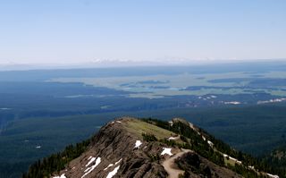
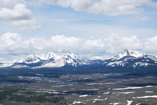
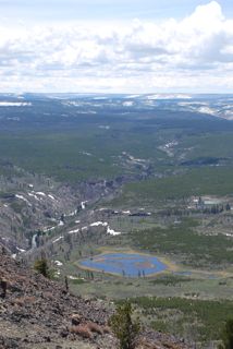
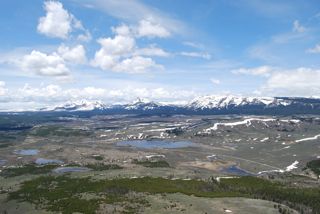
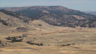
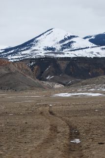
Slough Creek from Specimen RidgeYellowstone’s expanse of rolling hillsides and gentle meadows appear endless in most areas of the park, and today I gazed at miles of this sublime landscape. I ventured up Specimen Ridge, which overlooks Lamar Valley to the northeast, and the Grand Canyon of the Yellowstone to the south.

The trail wanders through sub-alpine meadows, all a comforting shade of brown with the arrival of fall. Small patches of the bright yellow dress of aspen trees decorated distant ridges. A lone bison munched on the sparse fare, and raised his head to consider my presence. Not wanting to disturb him (nor get charged) I gave him a wide berth.

Wolves frequent this area, although I was not lucky enough to see any today. The territories of the Slough, Druid, and Agate packs all intersect near Specimen Ridge and recent entries on the trail register indicate sightings.

The name Specimen Ridge, according to Yellowstone Place Names, originates from prospectors, as the area was known for its specimens of amethysts. Amethyst Mountain, 9,614 feet, is the highest point on the ridge.

I made a quick video of the 360 views from the north end of Specimen Ridge.


The Trek to Electric Peak

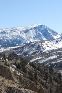
 Electric Peak in Winter From My HomeAt 6:00 am a group of seventeen intrepid hikers from the Yellowstone Association, Xanterra, and other park organizations gathered to meet for the day’s journey. Our mission was the summit of Electric Peak, the spectacular mountain that dominates the horizon of Gardiner, and the view from my home.

Normally the trek to Electric Peak involves a twenty-four mile round-trip hike, but for a few weeks each summer the USFS opens a dirt access road to the public, which shortens the journey to 14 miles.

Electric Peak BasinWe could not have picked a more perfect hiking day. Clear blue skies dominated, without even a hint of cumulus clouds—a break in the pattern of the last few weeks of consistent afternoon thunderstorms. Even the wind seemed to be resting as only a faint breeze blew at times.

  The approach from the north begins on the access road, and meanders through fire-scarred forests, wildflower covered hillsides, and an endless alpine meadow. Although a trail exists in some sections, much cross-country travel is required. The final push to the saddle involves walking on a precarious trail over loose scree, and then some fun scrambling up rock to the summit.

Trail to the Summit of Electric PeakElectric Peak, elevation 10,992 feet, (the sixth highest in the park) boasts some spectacular views. To the south the Grand Tetons are visible in the distance, while to the west Lone Peak and Sphinx Peak in the Madison Mountain range stand prominently on the horizon.

The peak’s distinct appearance is due to many geologic artists: formed from sedimentary rocks in the Cretaceous period, decorated by lava in the Eocene, and sculpted by glaciers during the last ice age. The mountain received its name when a member of the Hayden survey in 1872 was almost struck by lighting on the summit—you can read more about the story in another entry of my blog.
Given the distance required to reach Electric Peak, we think our group—along with four young Gardiner residents, and four park visitors who approached from the south—all hold the record for the most people on the summit at one time. After the hike, some of the group celebrated our accomplishment with beers and the delicious outdoor barbeque at the Two Bit Saloon and Raven Grill in Gardiner.
For more photos of the hike visit my photo gallery.

Team Electric

Mount Washburn

Mt%20Washburn%202.JPG.jpgI invite you to join me on my amazing hike up Mount Washburn. The Anderson’s, in their book A Ranger’s Guide to Yellowstone Day Hikes, advise that, “If you can hike only one trail in Yellowstone, it should be Mount Washburn.” The authors also quote a description of the peak from a early park visitor:

"If I could only choose one sight in the wonderland, it would be, by all means, that view from the top of Mount Washburn for you see there the entire park spread out before you in a single picture."

Dunraven%20Pass.JPG.jpgOn my drive to the trailhead, I rise over Dunraven Pass, awash with yellow flowers, and obtain a great view of the summit of Mt. Washburn. It’s original name might have been Elephant’s Back, but in 1870 the Washburn Expedition named it for General Henry Dan Washburn, leader of “one of the most important early explorations of Yellowstone,” according to Whittlesey’s Yellowstone Place Names. Dunraven Pass, 8,859 feet in elevation, bears the namesake of the First Earl of Dunraven, an Oxford educated man who was once guided in his explorations of the west by Buffalo Bill.

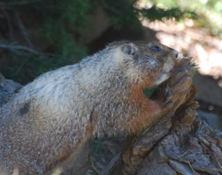
Early on my hike, I encounter a yellow-bellied marmot munching on a tree limb.
marmot on washburn trail.jpg.jpg

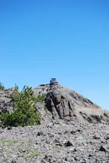
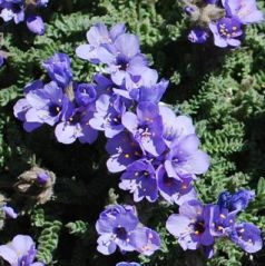
As I turn a corner, I see the Lookout Tower on the summit of Washburn. I also pass bouquets of the exquisite Sky Pilot gathered among the volcanic rocks.
mt washburn fire lookout.jpg.jpgsky pilot.jpg.jpg

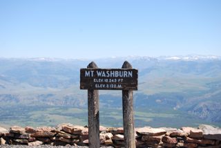
At the top of Mt Washburn, 10,243 feet, I gaze at the spectacular 360 degree view of the park.
washburn summit.jpg.jpg

The Grand Canyon of the Yellowstone
grand canyon of the yellowstone.jpg.jpg

Hayden Valley and the Grand Tetons in the distance
mt washhburn trail.jpg.jpg

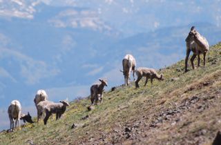
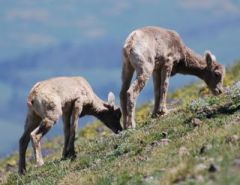
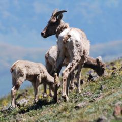
While I munch on my Luna Bar, a herd of bighorn sheep--with several lambs--join me.
big horn sheep herd.jpg.jpg

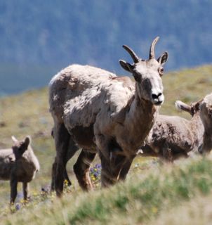
One bighorn ewe gazes at me inquisitively, perhaps wondering why I am munching on a chocolate bar when so many yummy grasses surround me.
big horn ewe washburn.jpg.jpg

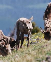
A lamb considers me as well, as two others graze nearby.
big horn lamb washburn 2.jpg copy.jpgtwo big horn lambs.jpg.jpg

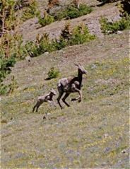
Something catches an ewe’s attention, which turns out to be a mother and lamb running to catch up with the herd.
ewe and lambs washburn.jpg.jpgewe and lamb running.jpg.jpg

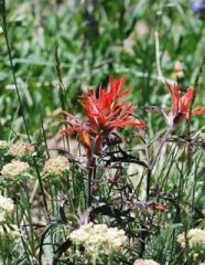
On the return trip, I stop to smell the flowers: paintbrush and silky phacelia
indian paintbrush 2.jpg.jpgsilky phacelia.jpg.jpg

Hellroaring Creek Trail

hellroaring trail.jpg.jpgHow could I pass up exploring an area with such an enticing name? The origin of the title, however, has no ties to Hades. According to Yellowstone Place Names, a prospector on a hunting trip in 1867 reported back to his group that the next stream was “a hell roarer.”

The beginning of the trail descends through a Douglas fir forest until it reaches the Yellowstone River. A sturdy suspension bridge spans the Black Canyon of the Yellowstone, and the river underneath rushes fiercely through the rock walls, perhaps angry at being confined to so small a space.

hellroaring mountain.jpg.jpgVelvety green rolling hills welcomed me once I climbed out of the river canyon, and the distinct Hellroaring Mountain dominated the landscape as I headed toward the creek. Hellroaring Mountain belongs more appropriately in my Yosemite world—it’s one of the rare peaks in the park composed of granite; indeed it’s Yellowstone’s largest granite outcropping. Most of Yellowstone’s peaks display rock formed from surface volcanic eruptions.

forget me not on hellroaring.jpg.jpgHellroaring Creek definitely lived up to its name. The mighty waters surged toward their destination and I was very glad I did not have to ford the creek. Instead, I picked a comfortable spot on the soft grass near the banks of the creek, and watched butterflies flutter from wildflower to wildflower.

Bunsen Peak & Sheepeater Cliffs

trilobite holmes dome antler.jpg.jpgSpring decided to make an appearance today in Yellowstone and I relished the intermittent sun peaking through the rapidly forming cumulus clouds. I climbed Bunsen Peak (8,564 ft), and my feet traveled over rocks some geologists think are 50 million years old and the remnants of an ancient volcano. The 360-degree view from the top proved to be quite spectacular and the horizon revealed a number of mountain ranges including the Gallatin, Washburn, and what I think might have been the Grand Tetons.

sheepeater canyon.jpg.jpgAs I noted in a prior entry, Bunsen peak is named for the German physicist Robert Wilhelm Bunsen, who invented the Bunsen burner. His scientific work on geysers contributed greatly to their study, but he never actually visited Yellowstone.

The name Sheepeater Cliff at first struck me as something out of a horror movie, but I later learned the designation refers to the Sheepeater Indians, or “Tukudeka,” the only Native Americans thought to spend the entire year in Yellowstone. According to Anderson’s great guidebook, A Ranger’s Guide to Yellowstone Day Hikes, “there’s evidence that the Tukudeka herded bighorn sheep off steep cliffs.”

On my hike along Sheepeater Canyon and the Gardner River, I met three Israeli young men who were traveling on a five-month road trip in North and South America. We hiked together for the last few miles and I enjoyed their company. Two of them had just finished their military service and were taking this trip before beginning university.

view of gallantin range.jpg.jpgOne of my companions asked me, “aren’t you scared hiking alone in grizzly country?” My answer was yes. During my hike today, I exhausted my entire repertoire of U2, Eagles, Beatles, and Counting Crow songs. At some point I wondered if a grizzly offended by my poor musical ability would attack me, so I switched to reciting T.S. Eliot and Yeats poetry. Nothing like a recitation of “The Second Coming” to put the potential of being mauled into perspective. For the record, I do realize hiking alone in grizzly country is risky, but solitary wandering is one of my joys in life.

By the way, if you want to see some stunning photography of Yellowstone by a talented artist, visit http://www.travelsinbearcountry.com/index.html

Mt. Everts and Bighorn Sheep

bighorn trotting.jpg copy.jpgAs I write this entry in my home office, a large furry head at the window startled me. About a dozen bison are grazing in my front yard and wandering around the house in search of better foraging.

Another gorgeous spring day and the temperature reached 65F. I hummed John Denver’s “Sunshine on My Shoulders,” and the Beatles, “Here Comes the Sun” on my hike up the shoulder of Mt. Everts in honor of the spring weather (and also needing to make noise as a grizzly precaution). Note to mom--I have been good about carrying bear spray on my excursions.

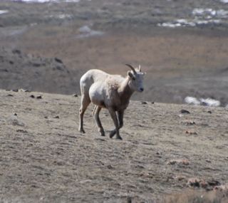
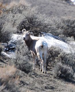
curious bighorn.jpg copy.jpgI went in search of bighorn sheep since they’ll be heading back to the higher elevations before too long as spring deepens. My luck was good: while munching on a Luna bar on a break, two sheep strolled over a ridge and began grazing about fifty feet away.

These animals lacked the striking curled horns and were either ewes or yearling rams. An adult ram’s horns, the size an indication of dominance and rank, can account for up to 12% of the animal’s body weight.

bunsen peak.jpg.jpgFor the rest of the afternoon, I continued to hike on the rolling hills in the basin along Mt. Everts, and studied the plethora of animals tracks, scat, and bones in the area. Mt. Everts was named for Truman C Everts, who was lost in 1870 for 37 days in the Yellowstone wilderness until Yellowstone Jack, a colorful adventurer, found him.

From my vantage point I also had a good view of Bunsen Peak (pictured at left), named for the noted chemist and physicist, Robert Wilhelm Bunsen, who invented the Bunsen gas burner and was the first scientist to take a serious interest in geyser activity.

I SURVIVED THE WINTER OF 2008! SPRING HAS ARRIVED!

"It's spring fever. That is what the name of it is. And when you've got it, you want - oh, you don't quite know what it is you do want, but it just fairly makes your heart ache, you want it so!" Mark Twain

"Science has never drummed up quite as effective a tranquilizing agent as a sunny spring day." W. Earl Hall

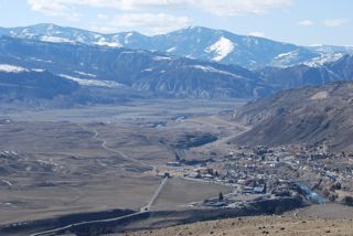
gardiner.jpg.jpgLiving in California for the past few years, I had forgotten the utter surge of joy and wonder that accompanies that first true day of spring.

In two-season California, except for at the higher elevations, winter never really arrives and most of us live in a perpetual, extended spring and summer; the seasons exist, but winter is pretty lazy in the sunshine state and summer never fully retreats. I love the California climate, but coming from New England I had a hard time calling a season winter when I could wear shorts and sandals.

pronghorn.jpgWinter is not shy in Montana and Wyoming. This past week I had a bleak moment of despair. I had hopefully donned a pair of shorts for a run one afternoon when the thermometer reached 42F. On the last mile of my run snowflakes fell on my bare legs.

I began to think spring had deserted us here up north, perhaps a result of climate change. I began to feel regretful about every light I hadn’t turned off when I left a room or every time I forgot a reusable shopping bag when I ran errands. Surely this was a punishment for my occasional environmental lapses.

Today, spring arrived, a poem of blue skies, warm sunshine, fluttering butterflies, and blossoming flowers. The temperature rose to 58F and even the southwestern wind blew warmly.

running pronghorn.jpg copy.jpgI hiked up the ridge (in shorts and a short sleeve shirt!) over Rescue Creek, stopping to examine the tiny white phlox flowers and the slender green leaves of the budding bitterroot. I also discovered wolf tracks, and while examining the canine footprints I watched an orange butterfly erratically flutter nearby. Bluebirds also flew overhead, landing frequently on the ground in search of a snack.

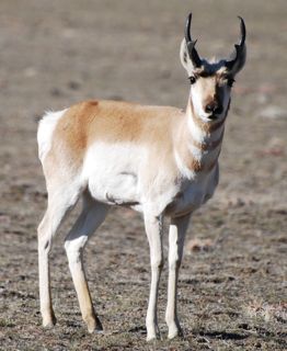
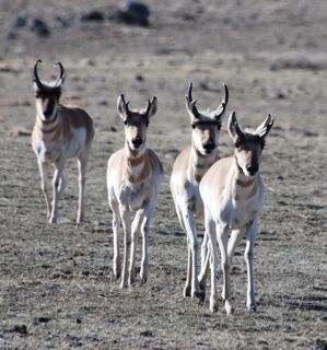
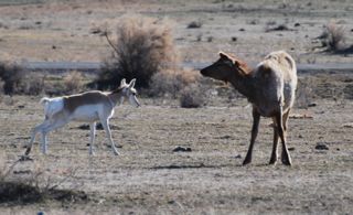
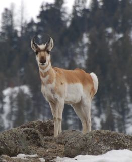
The resident ungulates also had spring fever. A herd of pronghorn antelope approached me on the trail, playfully trotting within twenty feet of me. They seemed to relish the sunshine as much as I did. Elk, bison, pronghorn and mule deer frolicked together in my front yard in a scene reminiscent of the peaceable kingdom.
elk and pronghorn.jpg.jpg

Hey, Grizz!

The grizzly bears have awoken after their long winter slumber, which means my semi-carefree days of hiking alone are over until next winter. I say semi-carefree, because bison present a year-round potential hazard.

As risky as hiking alone can be, I'm not willing to stop my solo backcountry wanderings--it's one of my great joys in life. So today I hiked alone (sorry mom), armed with binoculars, pepper spray, and a full repertoire of U2 songs. Instead of yelling the recommended "hey, grizz" every 100 feet, I prefer singing "Bullet the Blue Sky."
dainty pronghorn.jpg copy.jpg

For the first couple of miles, I thought every rock in the distance a grizzly, but I soon became adept at distinguishing rocks and trees from live bears. Being in the middle of the food chain heightened my awareness of my surroundings and my appreciation of being in true wilderness.

No bear sightings today, but I did encounter some dainty pronghorn, an elk hangout, and a herd of buffalo on the march.
buffalo march.jpg.jpg

American Serengeti

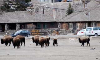
ungulate traffic.jpg .jpgThe northern range of Yellowstone has been dubbed by many the "American Serengeti" due to both the quantity and diversity of the wildlife. And I live right in the prime winter range of this area--creatures venture in my frontyard searching for forage at the lower elevations. I will miss my neighbors in the summer when they head for higher ground as I am now used to an assortment of animals greeting me when I open my door. See photo at right--that's my house and black Subaru amidst the bison, pronghorn and mule deer traffic!

rescue creek trail.jpgToday I hiked up the Rescue Creek Trail in search of bighorn sheep. I always hoped to see these delightful creatures in my wanderings in the Sierra high country, but the nearest I came was finding their scat on a hike up the Granite Divide. I've been lucky enough to see the bighorn twice since I've been in the park, but they're the one ungulate that doesn't frequent my front yard.

curious pronghorn.jpg copy.jpgIn just a five minute walk from my house, I arrived in a beautiful basin over 6,000 feet. I stopped frequently to scope out the ridge with my binoculars, and to watch the elk and pronghorn I encountered. I climbed up Rattlesnake Butte for a view of the Yellowstone River canyon, and tried to create an interesting backstory for the adjacent Turkey Pen Peak. For fifteen minutes I stood and observed two resting pronghorn antelope, but the bighorn sheep remained elusive.